
This post may contain affiliate links. If you book through them, I may earn a small commission at no extra cost to you. I only recommend personally curated options that make sense for cruise passengers and independent travellers.
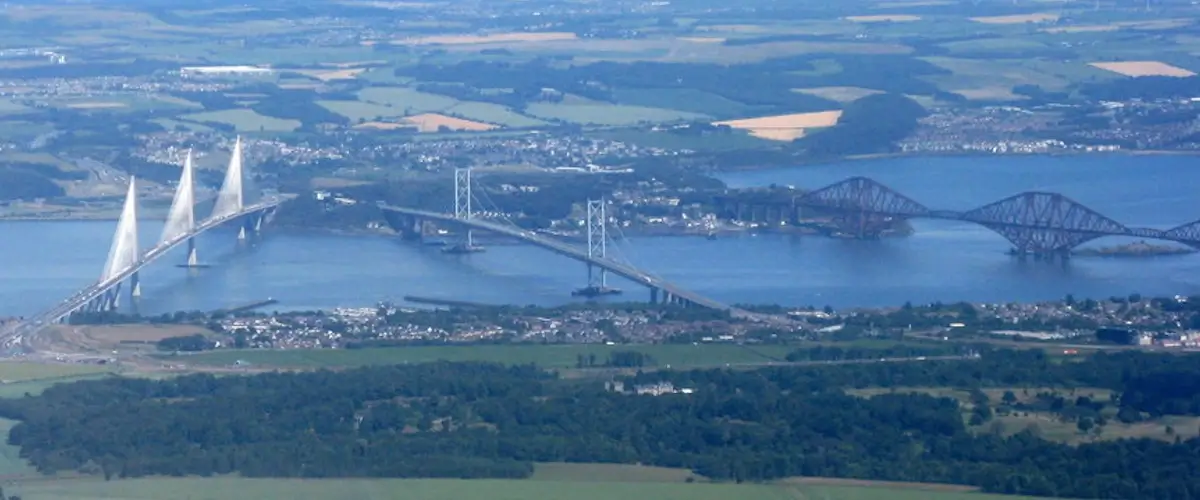
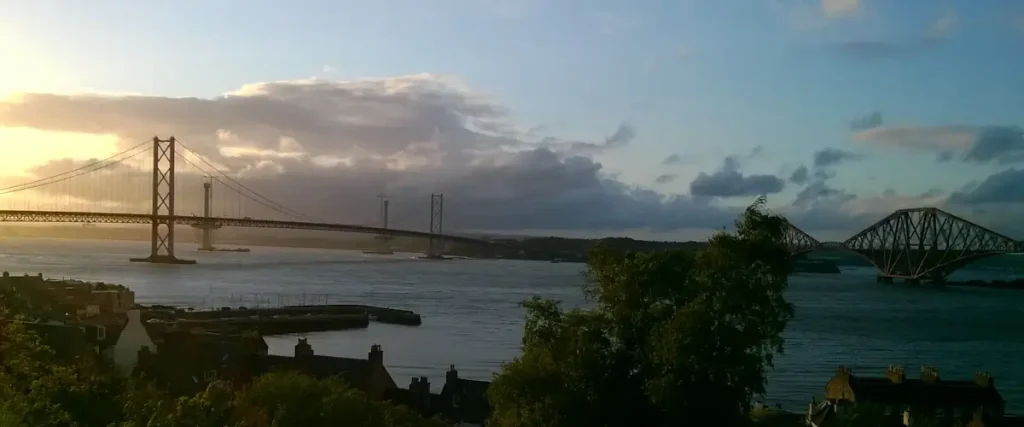
Stand on Hawes Pier and you can see all three Forth bridges at once. Almost everyone calls them “the Forth Bridge”. Only one of them is.
That’s where the confusion starts. The red steel giant, the suspension bridge beside it and the newest crossing upriver all get lumped under one name. Guidebooks and signs don’t always help. Some tourist are even confused about the name – wondering why there’s a Forth (fourth) bridge when there’s only three. “Where’s the other one? The fourth one?”
This guide sorts it out. Which bridge is which, what each one is for, who can use it, and why a town this size ended up with three.
In this guide
Key Takeaways
- The Forth bridges are three bridges across the Firth of Forth at South Queensferry: a railway bridge (1890), a road bridge (1964) and a motorway bridge (2017). You see all three from Hawes Pier.
- “The Forth Bridge” on its own means the red railway bridge. People use it loosely for all three.
- Only the Forth Road Bridge can be walked or cycled. The rail bridge takes trains only, and the Queensferry Crossing is motorway only.
- The Forth Road Bridge is now a public transport corridor for buses, taxis, walkers and cyclists.
- The Queensferry Crossing was built because the old road bridge’s main cables were found to be badly corroded.
What Are the Three Forth Bridges?
South Queensferry sits beneath three bridges over the Firth of Forth: the Forth Bridge, a railway cantilever opened in 1890; the Forth Road Bridge, a suspension bridge opened in 1964; and the Queensferry Crossing, a cable-stayed motorway bridge opened in 2017. They span three centuries, and all three still carry traffic.
Each one belongs to a different era of engineering. Steel and rivets in the 1890s, suspension cables in the 1960s, a slim cable-stayed deck in the 2010s.
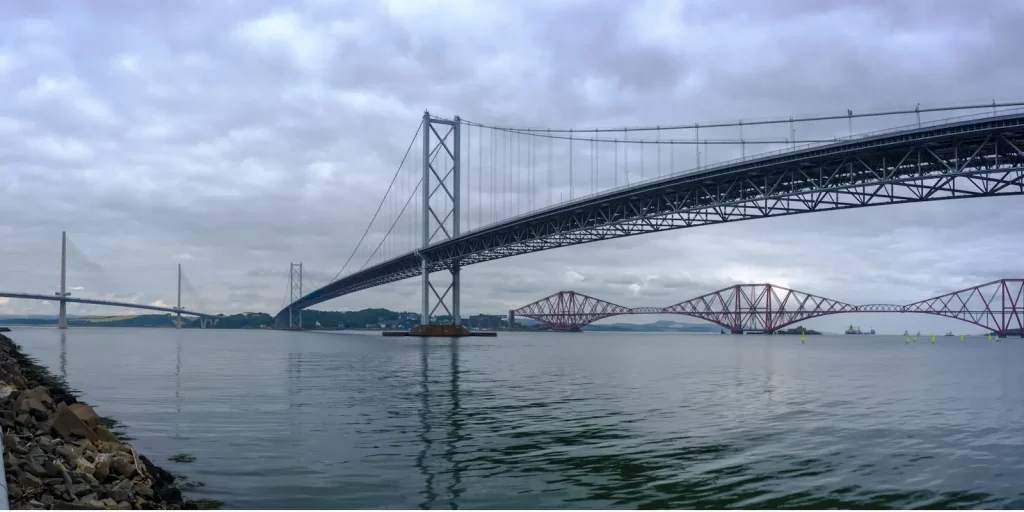
Locals say “the rail bridge”, “the road bridge” and “the new bridge”. Visitors hear all three called the Forth Bridge. It saves a lot of pointing if you use the proper names.
What Each of the Forth Bridges Looks Like
The three Forth bridges look nothing alike because they hold themselves up in three different ways. The Forth Bridge is a rust-red steel cantilever, the Forth Road Bridge is a suspension bridge hung from two main cables, and the Queensferry Crossing is a cable-stayed bridge with three slim towers. Once you have seen each one, you won’t mix them up.
Heavy, hanging, stayed. That’s the whole difference, and you can see it from the pier.
The Forth Bridge: A Rust-Red Steel Cantilever
The Forth Bridge is three double-cantilever towers of rust-red steel, each standing on four circular piers, with long girders reaching out from each tower to meet the next. It looks like machinery: no ornament, every tube and rivet on show. It is the oldest of the three and the nearest to the town.
UNESCO describes it as “one of the greatest cantilever trussed bridges“. Its unadorned, industrial look shows its structure openly and is source of awe for tourists seeing it for the first time. Historic Environment Scotland says it was Categroy A listed in 1973.
The Forth Road Bridge: A Suspension Bridge With Two Towers
The Forth Road Bridge is a suspension bridge, at the time of building, the longest in the world. It two steel towers carry two main cables, and the road deck hangs from them. Its 1,006 metre main span is one long, clear sweep with nothing underneath, the opposite of the rail bridge’s heavy frame. It sits in the middle of the three.
It was Category A listed in March 2001. (Source: Historic Environment Scotland.)
The Queensferry Crossing: A Cable-Stayed Bridge With Three Slim Towers
The Queensferry Crossing is a cable-stayed bridge. Three slender single-column towers rise from the water, and cables run straight from the towers down to the deck instead of hanging in a curve. It is the newest of the three, the furthest upriver, and the simplest in outline.
Transport Scotland’s own description is “three slender single column towers”. Next to the rail bridge it is a far lighter structure.
The Forth Bridge (1890): The Red Railway Cantilever
The Forth Bridge is a cantilever railway bridge designed by Sir John Fowler and Sir Benjamin Baker and built by William Arrol, opened on 4 March 1890 by the then Prince of Wales (later, King Edward VII). It is about 2.5 km long, uses more than 50,000 tonnes of steel and 6.5 million rivets, and carries trains only. Network Rail owns it.

Its main spans are 521 metres, and the three cantilever towers stand about 110 metres tall. Over 200 trains a day cross it.
It was listed in the UNESCO World Heritage Convention in 2017 and is not just a unique landmark in Queensferry, but a symbol of Scotland as a whole.
At its peak the build employed around 4,600 workers. The toll in lives was heavy: Wilhelm Westhofen recorded 57 deaths in 1890, and later research by Health and Safety Services puts the total higher at 73.
Why Is the Forth Bridge So Famous?
The Forth Bridge is famous because it had the longest cantilever span in the world when it opened, a record it held for nearly three decades, and it was among the first major structures built in steel. Its bare, riveted red frame is also unlike any other bridge, and UNESCO made it a World Heritage Site in 2017.
UNESCO inscribed it under two criteria: a masterpiece of human creative genius, and an outstanding illustration of a significant stage in human history.
There’s a darker reason it looks the way it does. The Forth was first meant to be crossed by a suspension bridge designed by Thomas Bouch. Then the Tay Bridge fell in December 1879, and Bouch’s design was formally abandoned in January 1881.
I stopped properly in Dundee once and saw what’s left of the original Tay Bridge in the water. It’s a short step from there to the Forth Bridge. Nobody was going to build the next one light.
Where Does the Forth Bridge Start and Finish?
The Forth Bridge runs from South Queensferry on the south shore of the Firth of Forth to North Queensferry in Fife. Trains pass Dalmeny station, cross the southern approach viaduct, then the three cantilevers, and reach North Queensferry station.
Dalmeny station opened in 1890, built for the Forth Bridge Company. The row of houses on Forth Park, running alongside the railway on the far side from the station entrance, was built to house workers. As I remember it, they were the bridge builders. Either way, the houses are tied to the railway and the bridge.
Dalmeny station is the station for South Queensferry, and it sits on the town’s edge, up the hill from the waterfront. It takes its name from Dalmeny, the village about a mile away, not from the town it serves.
As I understand it, South Queensferry didn’t stretch this far when the station was built, so it was named for the nearest place. The town has since grown out to meet it. The quick way down is the woodland staircase behind the Hawes Inn. Locals call it Jacob’s Ladder. Visitors don’t know the name, and don’t need it.
Inchgarvie is small, uninhabited and sits directly under the bridge. You can see it from the pier.
There’s a wartime story attached to it too. I learned at school that, during the Second World War, German propaganda used an aerial view of Inchgarvie as “proof” the bridge had been bombed, claiming the island’s smoke was from a bomb hit. The bridge was never knocked out.
The Forth Road Bridge (1964): Now for Buses, Walkers and Cyclists
The Forth Road Bridge is a suspension bridge opened by Queen Elizabeth II on 4 September 1964. It is over 2.5 km long with a main span of 1,006 metres. Since the Queensferry Crossing opened it has been a public transport corridor for buses, taxis, walkers and cyclists, rather than general traffic.

Construction began in September 1958. It replaced the Queensferry ferry, which had run across this stretch of water for centuries.
I remember the tolls. They were abolished on 11 February 2008.
Walking it is the best way to feel the scale. The full route, the wind and the sensible way home are in the guide to walking across the Forth Road Bridge.
The Queensferry Crossing (2017): The Three-Tower Motorway Bridge
The Queensferry Crossing is a three-tower cable-stayed bridge carrying the M90 motorway, about 1.7 miles (2.7 km) long including approaches. It opened to traffic on 30 August 2017. Each tower stands about 210 metres above high tide, making them the highest bridge towers in the UK. (Source: Transport Scotland.)
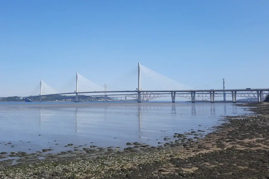
It is the longest three-tower cable-stayed bridge in the world, and by far the largest to have cables that cross at mid-span. There is no footway and no cycle path.
Wind shielding along the deck means it can stay open in conditions that used to shut the old road bridge.
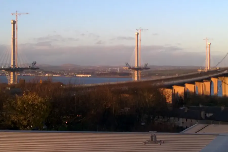
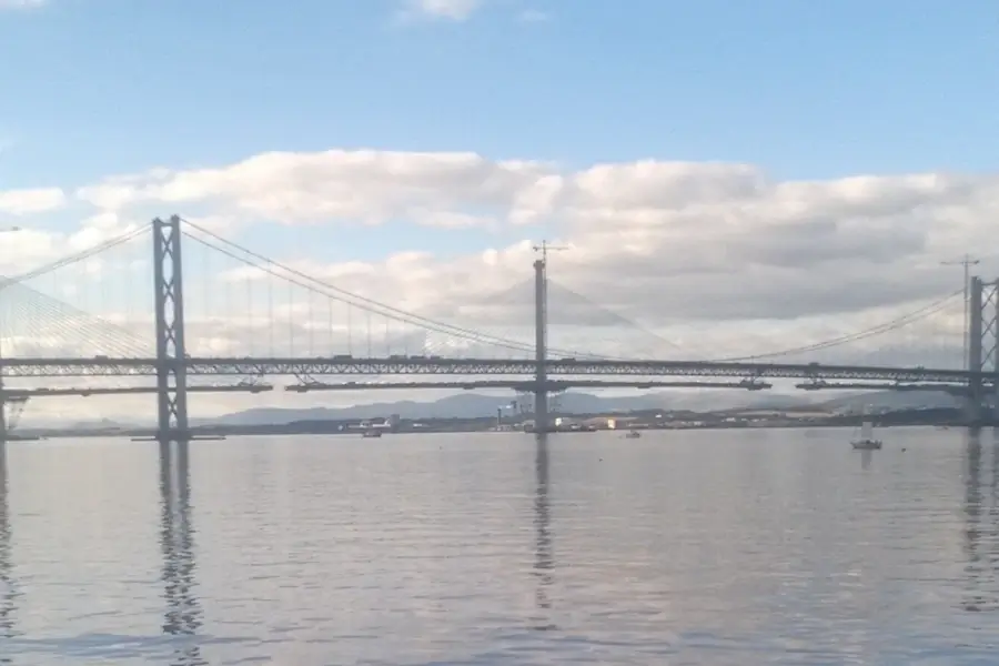
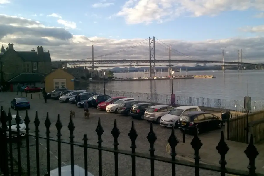
I left the Ferry in 1996, so I never watched the Crossing go up day to day. What I do have are my own photos from visits home, taken at various stages of construction. It was a very different skyline when I left.
Forth Bridges Compared: Dates, Lengths, Spans and Who Can Use Each
The three Forth bridges differ in type, age and use. The rail bridge carries trains only, the Forth Road Bridge carries buses, taxis, walkers and cyclists, and the Queensferry Crossing carries motorway traffic. The table below sets out opening date, length, main span, structure type and permitted users for each.
Sources: theforthbridges.org, UNESCO World Heritage Centre, Historic Environment Scotland. Check the bridge status page before you travel – access on the Forth Road Bridge changes with maintenance.
| Bridge | Opened and type | Length, main span and who can use it |
|---|---|---|
| Forth Bridge | 1890 · Cantilever | Length: about 2.5 km Main span: 521 m (two main spans) Users: trains only |
| Forth Road Bridge | 1964 · Suspension | Length: over 2.5 km Main span: 1,006 m Users: buses, taxis, walkers, cyclists, small motorcycles |
| Queensferry Crossing | 2017 · Cable-stayed | Length: 2.7 km Main span: [CHECK: 650 m – confirm with Transport Scotland] Users: motorway traffic only |
Is the Forth Bridge Still Being Painted?
No. The saying “like painting the Forth Bridge” describes a never-ending job, but a major refurbishment finished in 2011 and used a coating designed to last decades. The bridge still has a permanent maintenance team, so it is looked after continuously rather than repainted from end to end.
The old idea was that painters started at one end, reached the other and had to start again. That was never quite how it worked. Weathered patches got attention as they appeared.
Network Rail says the refurbishment coating was designed to last around 25 years. The paint used is a “specialist glass flake epoxy paint, similar to that used in the offshore oil industry“.
If you want the colour, it’s red. UNESCO’s own description calls it “a striking red”.
Which Forth Bridge Can You Walk, Cycle or Drive Across?
You can walk or cycle across the Forth Road Bridge, drive across the Queensferry Crossing, and cross the Forth Bridge by train only. Nobody can walk on the rail bridge, and the Queensferry Crossing has no footway. The Forth Road Bridge has separate footpaths and cycle tracks, with the east one the usual route.
- Forth Bridge: trains only
- Forth Road Bridge: pedestrians, cyclists, buses, taxis, motorcycles under 50cc
- Queensferry Crossing: motorway traffic, motorcycles 50cc and over
I walked the Forth Road Bridge once and carried on to Deep Sea World on the north side. Of the three, it’s the only one you can do on foot.
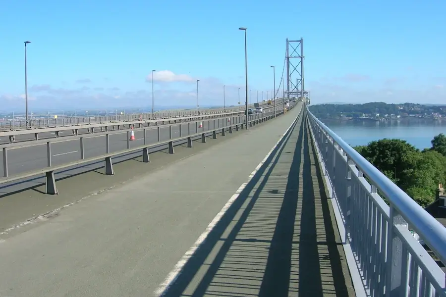
Check the footpath status before you go. At the last check the west footpath was closed for maintenance.
Where to See All Three Forth Bridges From South Queensferry
The easiest place to see all three Forth bridges together is South Queensferry’s waterfront. Hawes Pier and the Binks give a clear line across the water, and the walk west to Port Edgar opens up the Queensferry Crossing. For a fuller list of spots, see the viewpoints guide.
Sit down and the bridge view gets better. From a table, the Orocco Pier has the best panoramic view of the Forth Bridge in town. The Hawes Inn is the better overall experience, though it’s candlelit dinners now, not the Friday-night pub it was.
The photography guide covers where to stand and what time of day suits each bridge.
Why Are There Two Forth Road Bridges?
The Forth Road Bridge opened in 1964 and the Queensferry Crossing in 2017 because inspections of the older bridge’s main cables found severe corrosion. Scotland needed a replacement that could carry the M90, so the old bridge was kept as a public transport corridor for buses, taxis, walkers and cyclists.
The Scottish Government’s published response puts the corrosion finding at 2005/6, with the main cables estimated to be working with an 8 to 10 per cent loss of strength. Monitoring and dehumidification slowed the decline, but the conclusion was that the old bridge was not a viable long-term crossing.
So “two road bridges” is correct. The third one, the red one, is the railway. The longer story of how the town ended up under all of this is in the history chapter on the age of steam, rail and bridges.
The Forth Bridges: FAQs
Which Forth bridge is the red one?
The red one is the Forth Bridge, the railway cantilever bridge from 1890. The other two are the Forth Road Bridge and the Queensferry Crossing, and neither is red.
Is there a toll on the Queensferry Crossing?
No. Tolls on the Forth Road Bridge ended in February 2008, and the Queensferry Crossing has never charged one. [CHECK: confirm on Transport Scotland]
Can you walk across the Queensferry Crossing?
No. It is a motorway bridge with no footway or cycle path. Walkers and cyclists use the Forth Road Bridge next to it.
Can you take a boat trip under the Forth bridges?
Yes, boat trips run from South Queensferry and pass under the bridges. Sailings change by season and tide, so check the operator before you plan around one. [CHECK: operator and season]
Can you visit or tour the Forth Bridge itself?
You can see it from the waterfront and cross it by train from Dalmeny to North Queensferry. There is no pedestrian access to the bridge.
Queensferry from the air: M J Richardson, CC BY-SA 2.0
Picture: Forth Road Bridge path JThomas, CC BY-SA 2.0 via Wikimedia Commons.

Scott Gibson grew up in South Queensferry and runs queensferry.net. The Forth and Edinburgh guides come from lived experience — tender days at Hawes Pier, cruise traffic, the shortcuts into the city. For the wider Scotland cruise ports, he draws on friends in some of the port towns alongside port, operator and transport sources — so the detail holds up on the ground, not just on paper. Clear directions, real timings, no brochure fluff.