

This post may contain affiliate links. If you book through them, I may earn a small commission at no extra cost to you. I only recommend personally curated options that make sense for cruise passengers and independent travellers.
Want to walk across the Forth Road Bridge? Good choice if the weather is behaving on your day out in South Queensferry.
Most guides explain the boring version. Walk the length of the road bridge – or at least halfway – take some photos, stop, turn around, and walk back over the same stretch of grey steel.
That works. But it’s not the best way to do it.
The best way to walk the Forth Road Bridge turns the walk into a proper loop, linking South Queensferry, North Queensferry, sharks, the historic red Forth Bridge, and one of the most unique 5-minute train journeys most visitors to Queensferry miss. You may even encounter some sharks along the way.
You get the same bridges. Better sequence. Better things to see. Better views from the Forth Bridge itself.
First, though, you need to know which bridge you can actually walk across.
In this guide
- Quick facts
- Getting there from Queensferry High Street
- Getting there from Hawes Pier
- Getting there from Edinburgh
- The walk: what to expect
- The smarter return: walk north, train back
- Alternative from Edinburgh: train to North Queensferry first
- What’s in North Queensferry
- Photography: where to stand
- Frequently asked questions
Can You Walk Across the Forth Bridge?
You can walk across the Forth Bridge if you’re referring to the Forth Road Bridge. Technically, the Forth Bridge refers to the red cantilever railway bridge from 1890. The Forth Road Bridge was opened in 1964 and carried cars, buses, and heavy goods vehicles until 2017, when the Queensferry Crossing opened.
Now, the Forth Road Bridge is only used for buses and taxis, making the walk across the bridge a much more pleasant experience.
Local naming note: Around South Queensferry, you’ll sometimes hear people say “the Forth Bridge” when they’re talking loosely about the bridge area, the road bridge, or all three bridges together.
For this walk, follow the proper route name: Forth Road Bridge. That’s the one with the footpath.
Quick Facts
| What to know | Forth Road Bridge walk |
|---|---|
| Bridge distance | 1.5 miles (2.4 km) one way |
| Walking time | 30–45 minutes at a relaxed pace |
| Cost | Free |
| Which footpath | East side – the west has been closed for maintenance for several years |
| Wind closure threshold | 50mph – call 0131 319 3083 to check on the day |
| Train from Edinburgh | Waverley to Dalmeny, around 20 minutes, usually under £4 single |
| Smart return | North Queensferry Station to Waverley, around 15 minutes by train |
No ticket, no booking required. The footpath starts at the south end – you walk onto it.
Getting There From Edinburgh
The train is the most practical option and the one worth planning around.
ScotRail runs regular services from Edinburgh Waverley to Dalmeny Station in around 20 minutes. The single fare is typically under £4.
From Dalmeny, it’s a 20–25 minute walk downhill through South Queensferry to the bridge entrance. Follow the main street west along the waterfront. The viewpoint car park at EH30 9SF is well signposted from there.
Your three options:
- Train: Waverley to Dalmeny, ~20 min, from £6 return. Walk 10–15 minutes to the bridge entrance from the station. Note: The train station for South Queensferry is “Dalmeny”.
- Bus (recommended): Lothian 43 from St Andrew Square – disembark at the bus stop Walker Drive, just under the Forth Road Bridge; Stagecoach East Coast X55, X58, X59, X60 from Princes Street. Allow 25–40 minutes, depending on traffic. Disembark at the bus stop just before the bus crosses the Road Bridge.
- Car: Forth Bridges Viewpoint car park, EH30 9SF. Fills quickly on summer weekends — arriving before 10 am gives you the best chance of a space.
One thing that catches people out: Dalmeny is the station on the Edinburgh side of the water. North Queensferry Station is on the Fife side.
They’re not interchangeable. If you’re starting from Edinburgh, Dalmeny is your station.
Getting There From Hawes Pier
If your cruise ship tenders into South Queensferry, you’ll land at Hawes Pier, directly below the Forth Bridge.
To get to the Forth Road Bridge, walk to the west end of the High Street and continue along Hopetoun Road with Priory Church on your right and the Police Station on your left. The road goes left, and continues up the hill.
You’ll be directly under the bridge at the junction of Steward Terrace and Hopetoun Road. You’ll see the step up to the bridge. Walk up the road on the left. You want to be on the east side of the Road Bridge.
Allow 15–20 minutes from Hawes Pier to the bridge entrance. Add 30–45 minutes to cross the bridge one way, or around 2.5–3 hours if you plan to walk across, spend a short time in North Queensferry, Deep Sea World, and return to Dalmeny Station (South Queensferry) by train.
For a shorter cruise-day option, walk from Hawes Pier to the bridge entrance, go part-way across for the views, then return to South Queensferry. That keeps you close to the tender pier and leaves time for the High Street.
Check your last tender time before starting. On busy cruise calls, tender queues can build near departure time.
The Walk: What to Expect
East footpath vs west footpath
The east footpath is the one you’ll use.
The west side has been routinely closed to the public for several years — maintenance traffic uses it. The east path connects to National Cycle Route 1 and stays open in all conditions except wind above 50mph.
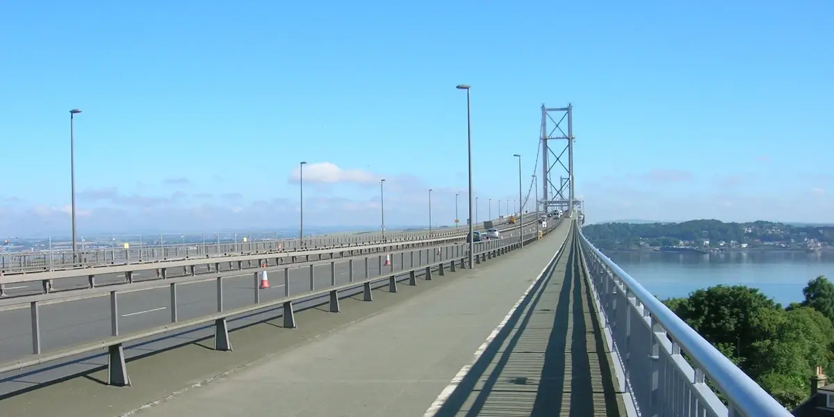
Heading north on the east path puts the Forth Bridge directly to your right. That’s where you’ll want your camera.
The crossing, step by step
- From the viewpoint car park, descend the steps to the footpath. The Contact & Education Centre at the base sometimes has activity packs for children if it’s open.
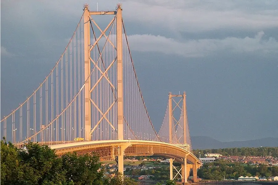
- Turn right onto the bridge. The path rises steadily toward the south tower. The suspension cables anchor here — the scale of the structure becomes clear before you’re fully committed to the crossing.
- Mid-span, between the two towers: a section of padlocks covers the central panels. These were sold in 2014 as part of an RNLI Queensferry Lifeboat Station fundraiser to mark the bridge’s 50th anniversary. They’ve stayed.
- Looking east from mid-span: the Forth Bridge sits at roughly eye level — red, angular, the cantilever arms spread wide over the water. It’s one of the best angles you’ll get of it from anywhere publicly accessible.
- North tower and descent to Fife. The Queensferry Crossing runs immediately to the west — close enough to study its cable-stay towers in detail as you go.
You’re walking at approximately 46 metres above the water.
The walkway is wide and the railing is solid, so it doesn’t feel exposed. Looking straight down makes the height obvious enough, but no one’s going near the edge.
Wind: what to actually expect
The bridge amplifies whatever the forecast says. A moderate Edinburgh day becomes something more deliberate by mid-span.
Practical notes:
- Hats belong in pockets or on straps
- Use a camera strap — the bridge moves slightly when a bus passes (normal, by design, but it affects focus)
- Closure threshold is 50mph. If the forecast is borderline, call Bridge Control on 0131 319 3083 before you go
The Smarter Return: Walk North, Train Back
Most guides suggest walking back the way you came — south again over the bridge, back to Dalmeny or the bus.
That works. But it means 3 miles of identical ground, and it misses the best return option on the whole trip.
Walk south to north. From the Fife end of the bridge, North Queensferry Station is a 5–10 minute walk uphill from the exit.
ScotRail runs regular services back to Edinburgh Waverley. The journey takes roughly 15 minutes — and it crosses the Forth Rail Bridge, the red cantilever, at rail height.
That’s a completely different angle on the same stretch of water. By the time you’re back in Edinburgh, you’ve walked one bridge and crossed two others.
It doesn’t feel contrived. It’s just how the geography works out.
If you are visiting Queensferry on a Scotland cruise, remember that you only travel one stop on the train from North Queensferry. You disembark at Dalmeny station. Then you walk back to the Hawes Pier through the woodland path under the Forth Bridge, or call a taxi.
Full loop timing from Dalmeny Station:
| Leg | Time |
|---|---|
| Walk to bridge entrance | ~30 min |
| Bridge crossing south to north | 30–45 min |
| North Queensferry village + food | 45–60 min |
| Train back to Waverley | ~15 min |
| Allow | ~4 to 5 hours |
Check current ScotRail timetables before you go — frequency varies through the day.
Alternative From Edinburgh: Train to North Queensferry First
For a stronger bridge-first route, take the train from Edinburgh Waverley to North Queensferry instead of Dalmeny.
This route crosses the red Forth Bridge by train before the walk begins. Sit on the left-hand side leaving Edinburgh for the best views down toward South Queensferry, Hawes Pier, and the road bridges.
From North Queensferry Station, walk downhill through the village to the Forth Road Bridge access. You then cross the Forth Road Bridge from north to south, with South Queensferry ahead of you and the Forth Bridge off to your left.
It is the same walk in reverse, but it feels different. You arrive by rail over the famous bridge, walk back over the suspension bridge, then finish in South Queensferry for lunch, photos, or the train back from Dalmeny.
Allow around 3–4 hours for the full route: train from Edinburgh, walk down through North Queensferry, cross the bridge, explore South Queensferry, then return from Dalmeny Station.
Best for: visitors who want the full three-bridge experience without doubling back.
For cruise passengers tendering at Hawes Pier: The reverse route isn’t the most logical one because you are already on the South Queensferry side, so it is simpler to start from the pier.
If you have time to spend in Queensferry before or after your walk over the Forth Road Bridge, use my guide to the best things to do in South Queensferry for ideas nearby, or head straight for the food with my where to eat in South Queensferry guide if the walk has done its work.
What’s in North Queensferry
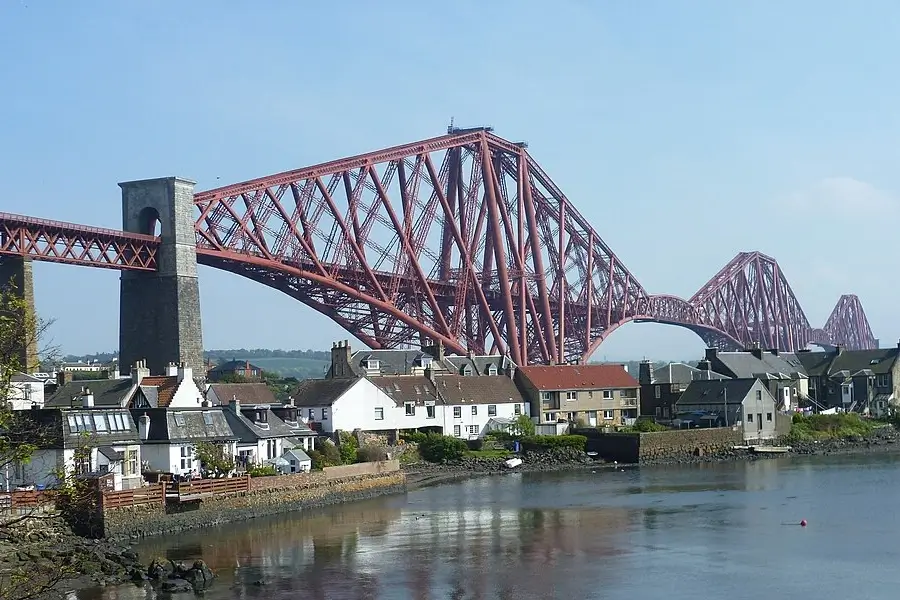
North Queensferry is a small village — one main street, a pier, and not much built for visitors.
That’s the point. It’s quieter than South Queensferry and feels less managed.
What you’ll find:
- Rankin’s Cafe and Deli — the standard post-walk stop. Local, good value, full menu. Gets busy on weekends. Check their Facebook page for daily specials and current hours before committing.
- Deep Sea World — Scotland’s national aquarium, sitting at water level directly beneath the Forth Rail Bridge. Sand tiger sharks, piranhas, a long underwater tunnel through a large shark tank. Worth the detour if you have children, or any interest in what lives under the estuary you just crossed.
- The pier — a 10-minute walk to the bottom of the village gives a low-angle view of all three bridges from the water. It’s a different composition from anything you get on the bridge itself, and worth a few minutes before heading up to the station.
Deep Sea World is well worth a stop on your “Walk Across the Forth Bridge” day out. It’s the place where you’ll see sharks on your walk. It has one of the longest underwater viewing tunnels in the world.
Photography: Where to Stand
Mid-span of the east footpath, looking east: this is the shot. The Forth Bridge fills the background, with the Hawes Pier and Queensferry on your right. You don’t need to search for the angle — it presents itself.
Other options:
- All three bridges together: Forth Bridges Viewpoint car park before you start. Elevated, clear sightline across all three spans.
- Same composition from the Fife side: North Queensferry pier at water level. Different enough to be worth comparing if photography is the purpose of the trip.
- Train crossing from North Queensferry to Dalmeny/Waverley: a quick shot from the carriage window gives you a rare view from the red Forth Bridge itself. Sit on the right-hand side travelling south toward South Queensferry and the road bridges.
- Winter evenings: the Forth Bridge is lit after dark. Underused by most visitors. Worth planning around if you’re local enough to time it.
Flat overcast light works well here. Avoid mid-afternoon on a clear summer day — the sun positions awkwardly behind the Forth Bridge for anyone on the east path heading west.
My guide to the best viewpoints in Queensferry will help you discover the best angles and places to photograph the bridges spanning the River Forth. You’ll also get some helpful tips in my Photography Guide to South Queensferry.
Frequently Asked Questions
Can you walk across the Forth Road Bridge?
Yes. The Forth Road Bridge has pedestrian footpaths on both sides. In practice, walkers use the east footpath – the west has been closed for maintenance for several years. Access is free and open year-round, except when wind speeds exceed 50mph.
Is it free to walk the Forth Road Bridge?
Yes. It is completely free to walk across the Forth Road Bridge. You do not need a ticket, booking, or permit. Just check the wind conditions before travelling, as the footpath can close when gusts reach 50mph.
How long does it take to walk across the Forth Road Bridge?
The bridge is 1.5 miles end to end. Allow 30–45 minutes at a relaxed pace with stops. The full loop from Dalmeny Station – cross to North Queensferry, time in the village, train back – takes around 3 to 4 hours.
Can cruise passengers walk to the Forth Road Bridge from Hawes Pier?
Yes. Cruise passengers tendering into Hawes Pier can walk to the Forth Road Bridge entrance in about 20 minutes. From there, allow 30–45 minutes to cross one way, or around 2.5–3 hours for a relaxed out-and-back with photo stops.
Can you walk across the Queensferry Crossing?
No. The Queensferry Crossing is a motorway and has no pedestrian or cyclist access. Walkers use the Forth Road Bridge, the 1964 suspension bridge between the red Forth Bridge and the newer Queensferry Crossing.
Can you walk across the red Forth Bridge?
No. The red Forth Bridge is a working railway bridge and is not open to pedestrians. You can ride across it by train between Dalmeny and North Queensferry, which is why the train return works so well.
Which footpath should I use – east or west?
Use the east footpath. The west side has been closed to general walkers for several years. The east path stays open in all but the most severe wind conditions and gives the best views of the red Forth Bridge.
What do you see walking across the Forth Road Bridge?
To the east, you see the Forth Bridge – the 1890 red cantilever railway bridge and UNESCO World Heritage Site. To the west, you see the Queensferry Crossing. Below is the Firth of Forth, roughly 46 metres beneath the walkway.
How do I get back to Edinburgh after crossing to North Queensferry?
Take the train from North Queensferry Station to Edinburgh Waverley. It is a short walk uphill from the bridge exit. The journey takes around 15 minutes and crosses the Forth Bridge at rail height.
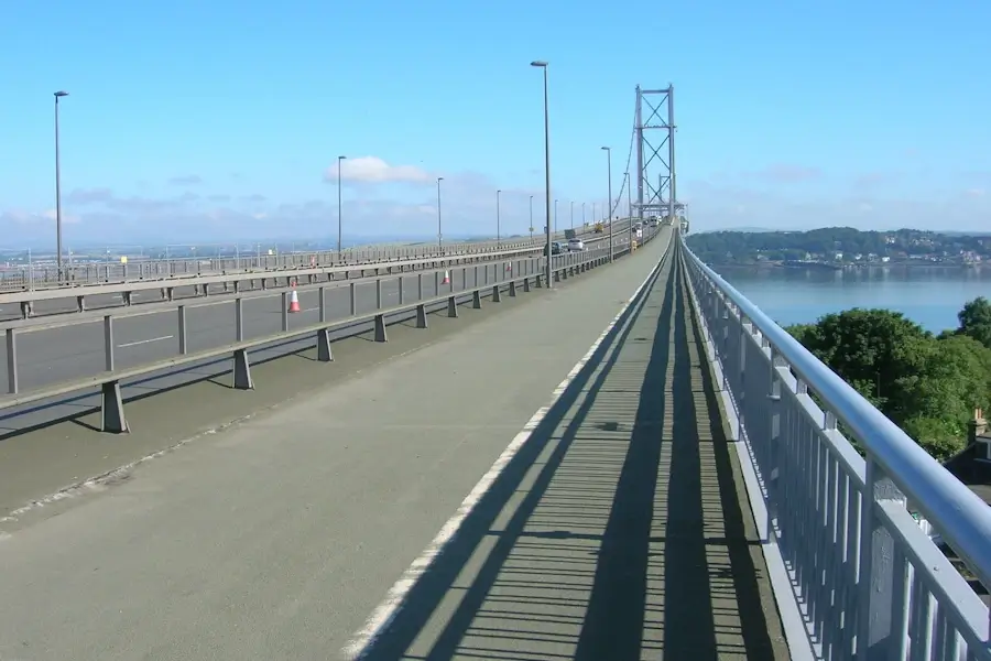
Picture: Forth Road Bridge path JThomas, CC BY-SA 2.0 via Wikimedia Commons.
Picture: Forth Road Bridge a dusk Mike McBey, CC BY-SA 2.0 via Wikimedia Commons.
Picture: Forth Bridge from North Queensferry Kim Traynor, CC BY-SA 2.0 via Wikimedia Commons.

Scott Gibson grew up in South Queensferry and runs queensferry.net. The Forth and Edinburgh guides come from lived experience — tender days at Hawes Pier, cruise traffic, the shortcuts into the city. For the wider Scotland cruise ports, he draws on friends in some of the port towns alongside port, operator and transport sources — so the detail holds up on the ground, not just on paper. Clear directions, real timings, no brochure fluff.