Walking the High Street as a child, never realising how unusual its terraces were or why they rose in that form, later made sense through estate records that show how ground, trade and frontage shaped the town’s early layout.
This chapter examines how 18th-century sea trade, merchant wealth and early industries reshaped Queensferry. It outlines the construction of key houses, the persistence of lang-rig plots, and the economic pressures that set the pattern for later urban development.
Geography and Physical Setting
The town’s position on a narrowing of the Forth shaped its commercial rhythm through the 1700s. A sheltered harbour, workable tides and a direct route to northern Europe made the place attractive to traders. The shoreline dictated where storage yards, vaults and access lanes could be placed, guiding later domestic construction.
Solid rock close to ground level limited how far plots could be levelled or reshaped. Builders adapted by working around gradients rather than against them, concentrating large houses on higher, firmer ground. This physical constraint encouraged the terraced arrangement seen along the High Street, a structure already visible in early sketches of the period.
The steep rise behind the street forced merchants to bring their work forward, creating storage chambers and yards on the street side. These solutions, dictated by terrain, established a streetscape where commercial and domestic spaces sat unusually close together, a pattern that endured well into the 19th century.
The tidal edge remained central to daily life. Ships and smaller coastal vessels needed predictable approaches, so the working end of town naturally settled westward. This steady use left lasting marks in foundations and access points that align with surviving property boundaries.
Maps, Surveys and Early Descriptions
Early descriptions and surviving maps show the High Street already functioning as the central artery of a trading settlement. Property divisions ran in long, narrow strips behind the street, an arrangement consistent with the lang-rig system used across other burghs. These rigs framed how houses grew and how tradespeople organised their yards.
Estate papers from Dalmeny and Dundas lands indicate steady adjustments to boundaries as merchants sought additional frontage. Wider street plots correlated with higher status and commercial influence. These patterns help explain the distribution of large houses such as Black Castle and Plewlands along the more desirable stretches.
Survey notations from the mid-18th century reference substantial stone buildings replacing older timber structures. The shift reflects rising prosperity and a preference for durable materials suited to both storage and residence. The detailing of crowsteps and harling recorded in these surveys matches what still stands in the East and Mid Terraces.
Shipping lists and import records help corroborate the scale of trade. Goods moved through the harbour often exceeded local consumption, pointing to Queensferry’s role as a redistribution point for inland settlements. These archival patterns align with the improvement of merchant houses built with cargo handling and oversight in mind.
Early Industries and Local Economy
By the early 1700s, Queensferry’s economy rested on outward-looking trade. Soap-making, reliant on imported kelp and tallow, was one of the first structured industries. Though modest in scale, it created regular demand for coastal transport and helped tie the town more closely to northern trade routes.
Small-scale distilling had long been present, but tighter national regulation in the early 18th century made legal operations more profitable. This shift encouraged formal production within the burgh, with merchants investing in premises linked to their broader trading networks. Distilling added another layer to the town’s mixed economy.
Herring fishing and the associated salt-curing trade expanded through the century. Export ledgers show consistent movement of preserved fish to Baltic ports. This activity brought income to households beyond the merchant class and reinforced the High Street’s status as a service corridor supporting maritime labour.
Timber, linen, tallow and general merchandise passed frequently through the harbour. Despite its small size, the town handled a diverse range of cargo. This variety insulated Queensferry from the severe downturns faced by more specialised ports and contributed to the steady construction of durable, stone-built homes.
Work, Trade and Daily Movement
Merchant families organised their work across the lang-rig plots, with storage, byres or workshops placed behind the main houses. These narrow strips enabled small-scale production or packing work without crowding the street. Surviving rig boundaries still mirror these early economic functions.
The movement of goods relied on predictable routines. Vessels anchored offshore when tides were unfavourable, and carts moved between the harbour and the upper town on a set of well-worn paths. This traffic shaped the High Street’s surface and influenced decisions on where to position weighing beams and market spaces.
Local carters and labourers played a key role in linking house-based enterprise with maritime trade. Their daily routes aligned with the narrow closes that survive between the terraces. The physical wear recorded in some of these passages hints at sustained, repetitive movement tied to loading and unloading practices.
Imported items such as wine, linen and timber entered domestic life subtly but persistently. Household inventories from the period show a gradual shift towards goods reflecting wider European influence, reinforcing the outward-facing nature of Queensferry’s economy.
Social Structure and Community Life
Merchant prominence affected the rhythm of local governance. Burgess status tied directly to property frontage and economic standing, reinforcing a hierarchy visible in surviving architecture. The larger houses functioned not only as residences but as statements of stability and access to trade.
Religious life continued to shape behaviour, but the economic emphasis of the town meant many families balanced church obligations with the practical demands of running ships, stores and workshops. The kirk session often recorded cases relating to work schedules, travel and Sabbath conduct connected to trade.
Inns and lodging houses served both locals and visiting traders. Their strategic placement near the Vennel and Mid Terrace reflects a demand for overnight accommodation linked to cargo movement and tidal patterns. These establishments also functioned as informal exchanges for news from across the North Sea.
Craft workers and labourers occupied smaller properties along narrower frontages. Their proximity to merchants created a tightly interdependent community. The shared reliance on the harbour meant that prosperity or decline was felt across all social levels in roughly equal measure.
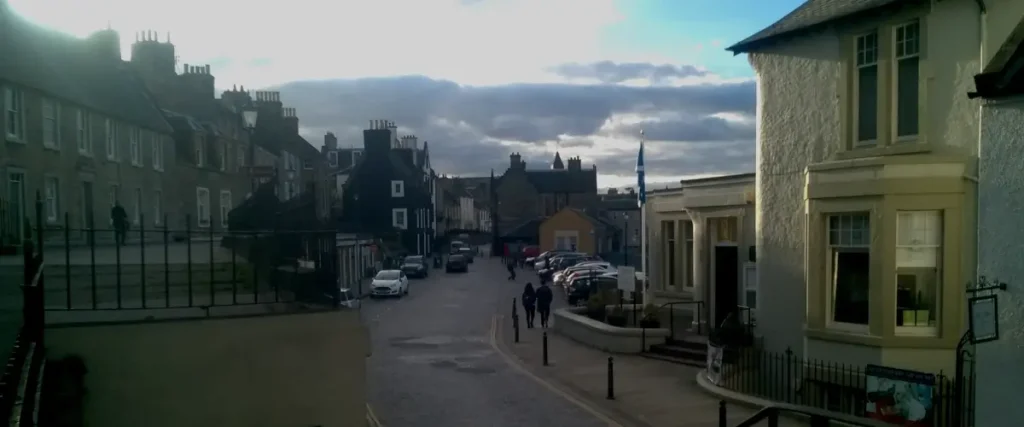
The High Street remains the centre of activity in Queensferry. What began as a merchant spine during the town’s trading peak is now the route most visitors follow when exploring the town.
Surviving Structures and Place Names
Black Castle, built in the early 17th century and modernised in later decades, anchors the east end of the High Street. Its scale and detailing reflect long-standing merchant wealth, and its survival provides a clear reference point for the architectural ambitions of the 1700s.
Laburnam House, altered through terrace construction, shows how land constraints shaped building forms. Its vaults and yard arrangements correspond closely to the functional needs of merchants handling cargo. These features reveal the practical priorities behind its construction rather than any pursuit of ornament.
Plewlands House, standing near the Tolbooth, represents a later phase of improvement. Its plan and finishing convey an increased confidence in masonry work. The building’s endurance demonstrates the prosperity of the period and the continued importance of the west end as a commercial zone.
Many closes still follow the lines of earlier access points. Their names, though sometimes altered, hint at trades once carried out within the rigs. The persistence of these routes reflects how little the underlying layout has changed since the height of merchant activity.
How This Shaped the Ferry Town
The 1700s laid down most of the structural and social patterns recognisable today. Merchant investment framed the High Street’s character, while the lang-rig layout set lasting boundaries for development. Trade with Europe ensured steady income, enabling durable construction that survived later economic shifts.
This foundation influenced the town’s resilience during the industrial changes of the 19th century. The layout, property system and maritime orientation created a template for expansion without erasing earlier forms. The next chapter follows how these inherited patterns met the pressures of railways, engineering and modern communications.
Queensferry History Companion (Chapters)

A chapter-by-chapter historical reference
- Chapter 1 – Before Queensferry
- Chapter 2 – Early Crossings
- Chapter 3 – The Making of a Medieval Settlement
- Chapter 4 – Burgh Rights
- Chapter 5 –Turbulent Times
- Chapter 6 – 1700s Prosperity
- Chapter 7 – The Industrial Rise of The Ferry
- Chapter 8 – Steam, Railways, the Coming of the Bridges
- Chapter 9 – Queensferry in Wartime
- Chapter 10 – Modern Queensferry